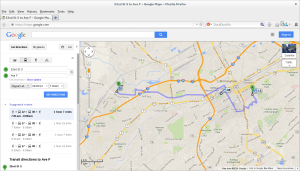
Congratulations to the BJCTA for getting trip planning available on Google Maps. It’s been a long time coming and a lot of hard work, but our transit system has finally caught up with the times. Next up: real time feeds of buses!

Congratulations to the BJCTA for getting trip planning available on Google Maps. It’s been a long time coming and a lot of hard work, but our transit system has finally caught up with the times. Next up: real time feeds of buses!

I have updated the trip planner (http://bjctatripplanner.org). These changes fix several variants of the #1 and include several trips that were missing. The #1 should now be accurate including the #1 express service. The trip planner is already up to date and so is the android app. Hopstop and other 3rd party apps should update over the next week.
Weld recently did a two part series on the status of the BJCTA Bus System. My trip planner was featured in the second part. You can read it online from the links below:
Part 1 is a very interesting look at the decline of the bus system since the 1950s and the turmoil and political games around transit in Birmingham. Part 2 takes a look at what is being done now to improve the system along with stories from riders who rely on the system.
Last night I was waiting on a bus in 5 points after some drinks with friends. Among the 12 of us who were waiting on a bus, I noticed two young girls, who we clearly not from Birmingham, looking at their phones to figure out what bus to ride to get back to their hotel near the convention center. As I looked over their shoulder, I saw they were using my App! That right there was enough to make me realize that all the work I’ve been doing for the last 1.5 years has been worth it! So, if you haven’t already, give the buses a try and use my app to help you.
I have updated the trip planner web site, and I have purchased a new domain. You can now reach it at:
I have updated the trip planner for the BJCTA Max buses to include new routes. The 41 Fairfield has been completed. You can download the data off of the GTFS Data Exchange.
My Trip Planner already includes the latest data. Or you can download my Android App for free from below.
If you have an iPhone, you can download a 3rd party app called Hop Stop.
Microsoft’s Bing Maps now includes my GTFS bus data for the Birmingham-Jefferson County Transit Authority (BJCTA). This means you can use Bing Maps to plan all your bus trips through Birmingham on the MAX buses! This is great news! Here’s an example:
I have updated the trip planner for the BJCTA Max buses to include new routes. The 1 Express, 45 Express, 44 Montevallo, and 6 Pratt-Ensley have all been completed. You can download the data off of the GTFS Data Exchange.
My Trip Planner already includes the latest data. Or you can download my Android App for free from below.
If you have an iPhone, you can download a 3rd party app called Hop Stop.
Google has recently updated all their imagery for Google Street View in Birmingham, AL. Not only are the images much higher quality, but they have expanded their areas of coverage too.
This is great news for my Bus Stop Cataloging project! This will make it much easier to use my StreetView cataloger website. It is now easier to see the bus stop posts, the data is more recent and therefore more accurate to some of the newer route changes, and it covers more areas which means I can finally go back and fill in those missing spots!
If you’d like to help out, please visit my StreetView Cataloging website and start finding bus stops!
I have updated the GTFS data for both the tripplanner and on the GTFS Data Exchange. This adds in support for loops. This means we are now starting to support the DART trolley routes! Additionally, this adds in block support which dramatically improves routing in cases where the rider needs to stay on the bus when the bus changes from an outbound to an inbound route.
For example, the US31 route travels down US31 until it the Galleria Mall. At the Galleria Mall, the outbound trip stops and the inbound trip begins. However, on the inbound trip, the bus leaves the Galleria, and instead of going back the way it came, it loops up through Lorna road before eventually meeting up with US31 and continuing back to Central Station. This means if you are somewhere on US31 and want to go to downtown, you actually need to catch the outbound bus, ride it to the Galleria, stay on the bus as it switches to the inbound route, and ride it to downtown. Without the blocks, the routing algorithm was having trouble switching from outbound to inbound, and assumed the rider must exit the bus and make the transfer. Because the transfer time is less than 1 minute, the algorithm would tell the rider to get off the bus, and wait 30 minutes for the next bus! This is now fixed, and the algorithm now knows that the rider can stay on the bus and continue to Central Station. This should help along any of the routes that have loops.